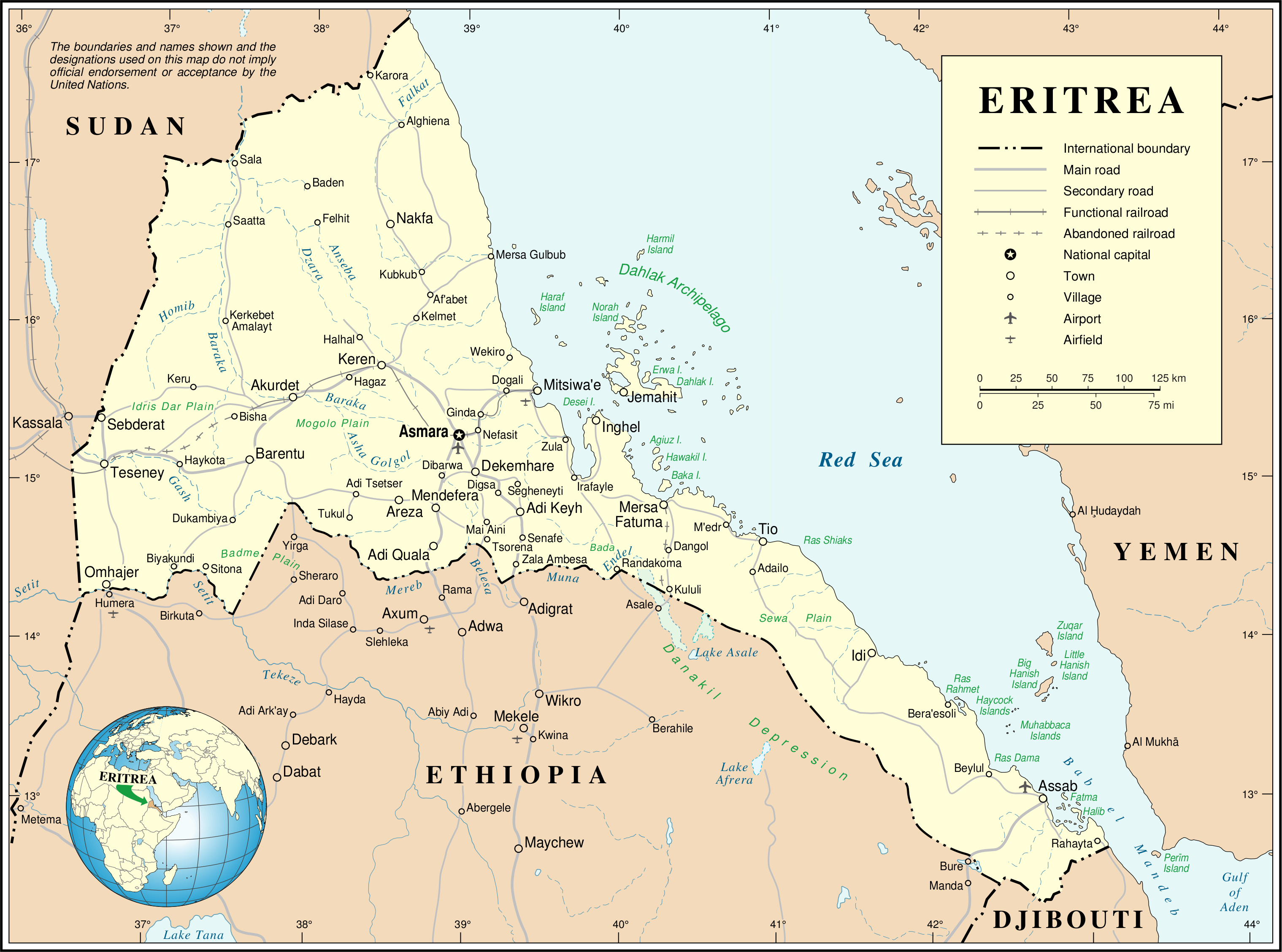
Fil:Un-eritrea.png
Opprinnelig fil (3 038 × 2 257 piksler, filstørrelse: 1,26 MB, MIME-type: image/png)

|
Dette bildet bør gjenskapes med hjelp av vektorgrafikk som en SVG-fil. Dette har flere fordeler, se Commons:Media for cleanup for mer informasjon. Hvis en SVG-fil med dette bildet er tilgjengelig, vennligst last den opp. Etter opplasting erstatt denne malen med {{vector version available|nytt bilde.svg}}.
|
| This image is a map derived from a United Nations map.
Unless stated otherwise, UN maps are to be considered in the public domain. This applies worldwide. UN maps are, in principle, open source material and you can use them in your work or for making your own map. UN requests however that you delete the UN name, logo and reference number upon any modification to the map. Content of your map will be your responsibility. You can state in your publication, if you wish, something like: based on UN map … (map name, map number, revision number and date). See: Geospatial Information Section. And: Geospatial, location data for a better world. |
 |
Filhistorikk
Klikk på et tidspunkt for å vise filen slik den var på det tidspunktet.
| Dato/klokkeslett | Miniatyrbilde | Dimensjoner | Bruker | Kommentar | |
|---|---|---|---|---|---|
| nåværende | 24. okt. 2007 kl. 02:57 | | 3 038 × 2 257 (1,26 MB) | wikimediacommons>Renamed user 73876485f2f7c42af5f2a33994cf3cb0 | {{UN map}} Category:Maps of Eritrea |
Filbruk
Den følgende siden bruker denne filen: