Fil:Proposed flag of Antarctica (Graham Bartram).svg
Hopp til navigering
Hopp til søk

Størrelse for denne PNG-forhåndsvisningen av denne SVG-filen: 800 × 533 piksler Andre oppløsninger: 320 × 213 piksler | 640 × 427 piksler | 1 024 × 683 piksler | 1 280 × 853 piksler | 2 560 × 1 707 piksler.
Opprinnelig fil (SVG-fil, standardstørrelse 900 × 600 piksler, filstørrelse: 6 KB)
.svg)
Beskrivelse
| Beskrivelse |
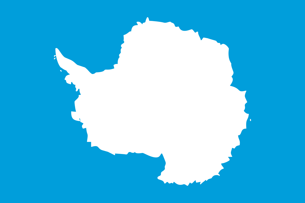
English: One of several flag proposals for Antarctica.
Deutsch: Flaggenvorschlag für die Antarktis.
Español: Un de varios banderas propuesta de Antártida.
Italiano: Una delle bandiere proposte per l'Antartide.
Plattdüütsch: Vörslag för ene Flagg vun Antarktika. |
| Dato | |
| Kilde | Open Clip Art Library |
| Opphavsperson | Tobias Jakobs |
| Flag of Antarctica | |
|---|---|
| used by | Antarctica |
| current since | never |
| created by | Graham Bartram |
| format | 3:2 |
| shape | rectangular |
| FIAV | |
| colours | blue, white |
| other characteristics | flag includes a map of the territory of Antarctica |
Lisensiering
This file is in the public domain because it consists of a geographic shape or natural outline, in United Nations blue and white colors, with insufficient additional creativity to reach the threshold of originality. (Note: The design is similar to one used by the 3D Atlas program which was owned/copyrighted by The MultiMedia Corporation, part of Creative Wonders/Electronic Arts)
|
|
This file is from the Open Clip Art Library, which released it explicitly into the public domain (see here).
To the uploader: Please provide as parameter the link to the page where this image appears. |
| Denne filen er gjort tilgjengelig under lisensen Creative Commons CC0 1.0 Universal Fristatus-erklæring. | |
| Personen som koblet et verk med dette dokumentet har tilegnet arbeidet til allmennheten ved, i den utstrekning loven tillater det, å avstå fra alle de rettigheter vedkommende skulle hatt ifølge opphavsrettsloven og andre relaterte eller nærliggende juridiske rettigheter. Verk under CC0 krever ikke attributtering. Ved bruk av verket trenger du ikke å få godkjennelse fra opphavspersonen.
|
Filhistorikk
Klikk på et tidspunkt for å vise filen slik den var på det tidspunktet.
| Dato/klokkeslett | Miniatyrbilde | Dimensjoner | Bruker | Kommentar | |
|---|---|---|---|---|---|
| nåværende | 4. feb. 2026 kl. 15:58 | | 900 × 600 (6 KB) | wikimediacommons>Mulan11111 | Reverted to version as of 22:23, 7 December 2024 (UTC) vandalism |
Filbruk
De følgende 2 sidene bruker denne filen:
.svg)