Fil:NASA Mando-Koresand.png
Hopp til navigering
Hopp til søk
Størrelse på denne forhåndsvisningen: 612 × 599 piksler. Andre oppløsninger: 245 × 240 piksler | 620 × 607 piksler.
Opprinnelig fil (620 × 607 piksler, filstørrelse: 962 KB, MIME-type: image/png)
Beskrivelse
| Beskrivelse |
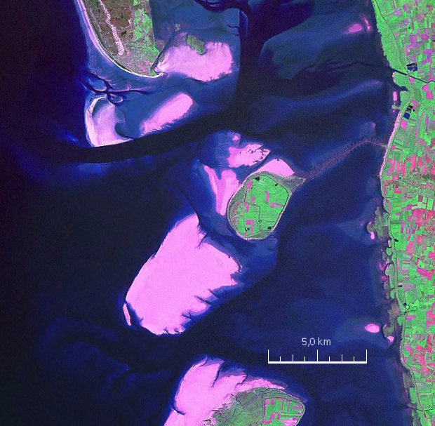
English: Mandø, the Danish Wadden Island, with Koresand close southwest, Fanø to the north, Romø to the south and the Jutland mainland coast to the east |
| Dato | |
| Kilde | NASA World Wind Screen Shot |
| Opphavsperson | NASA |
Lisensiering
| This image is in the public domain because it is a screenshot from NASA’s globe software World Wind using a public domain layer, such as Blue Marble, MODIS, Landsat, SRTM, USGS or GLOBE.
|
 |
| Annotations | This image is annotated: View the annotations at Commons |
Filhistorikk
Klikk på et tidspunkt for å vise filen slik den var på det tidspunktet.
| Dato/klokkeslett | Miniatyrbilde | Dimensjoner | Bruker | Kommentar | |
|---|---|---|---|---|---|
| nåværende | 19. aug. 2009 kl. 19:57 | | 620 × 607 (962 KB) | wikimediacommons>Ratzer | {{Information |Description={{en|1=Mandø, the Danish Wadden Island, with Koresand close southwest, Fanø to the north, Romø to the south and the Jutland mainland coast to the east}} |Source=NASA World Wind Screen Shot |Author=NASA |Date=2000 |Permission= |
Filbruk
Den følgende siden bruker denne filen: