Fil:Fukushima I NPP 1975 medium crop.jpg
Hopp til navigering
Hopp til søk
Størrelse på denne forhåndsvisningen: 800 × 404 piksler. Andre oppløsninger: 320 × 162 piksler | 640 × 323 piksler | 1 024 × 517 piksler | 1 584 × 800 piksler.
Opprinnelig fil (1 584 × 800 piksler, filstørrelse: 249 KB, MIME-type: image/jpeg)
Beskrivelse
| Beskrivelse |
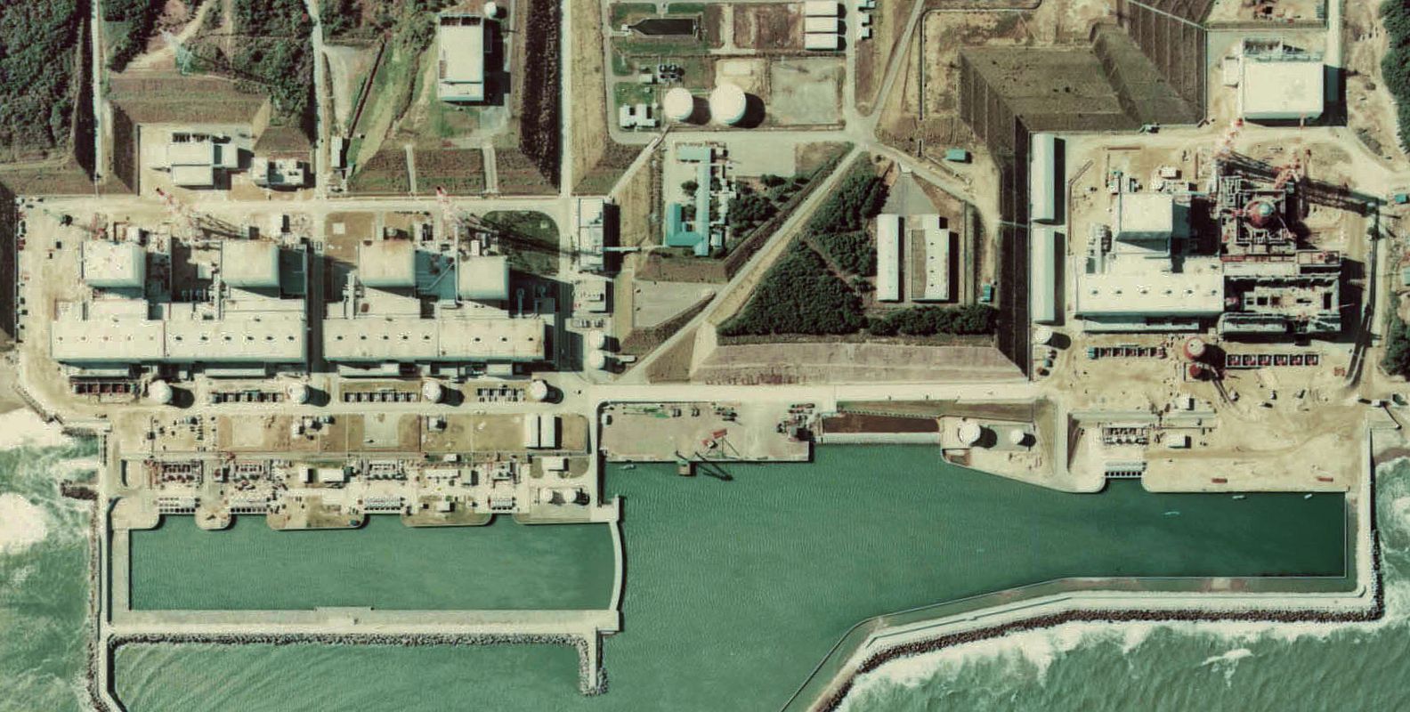
English: Fukushima I Nuclear Power Plant. Medium crop showing reactors 4, 3, 2 and 1, reading left to right, at the left (South), reactor 5 and the construction site for reactor 6 at the right (North).
日本語: 福島第一原子力発電所。 |
| Dato | |
| Kilde | http://w3land.mlit.go.jp/cgi-bin/WebGIS2/WC_AirPhoto.cgi?IT=p&DT=n&PFN=CTO-75-30&PCN=C29B&IDX=21 |
| Opphavsperson | Ministry of Land, Infrastructure, Transport and Tourism |
| Andre versjoner |
|


| Kameraposisjon | | Dette og andre bilder på denne posisjonen på: OpenStreetMap |
|---|
Lisensiering

|
Denne filens rettighetsinnehaver, the Ministry of Land, Infrastructure, Transport and Tourism of Japan, tillater alle å bruke filen til ethvert formål, forutsatt at rettighetsinnehaver blir korrekt kreditert. Redistribusjon, bearbeidelser, kommersiell bruk, og alle andre anvendelser er tillatt. |
Navngivelse:
Copyright © National Land Image Information (Color Aerial Photographs), Ministry of Land, Infrastructure, Transport and Tourism
|
| Annotations | This image is annotated: View the annotations at Commons |
Filhistorikk
Klikk på et tidspunkt for å vise filen slik den var på det tidspunktet.
| Dato/klokkeslett | Miniatyrbilde | Dimensjoner | Bruker | Kommentar | |
|---|---|---|---|---|---|
| nåværende | 16. mar. 2011 kl. 00:01 | | 1 584 × 800 (249 KB) | wikimediacommons>84user | Reverted to version as of 16:56, 13 March 2011; rotated image moved to File:Fukushima I NPP 1975 medium crop rotated labeled.jpg |
Filbruk
Den følgende siden bruker denne filen: