Fil:BelgicaI GermaniaI.jpg
Hopp til navigering
Hopp til søk
Størrelse på denne forhåndsvisningen: 500 × 600 piksler. Andre oppløsninger: 200 × 240 piksler | 587 × 704 piksler.
Opprinnelig fil (587 × 704 piksler, filstørrelse: 164 KB, MIME-type: image/jpeg)
Beskrivelse
| Beskrivelse |
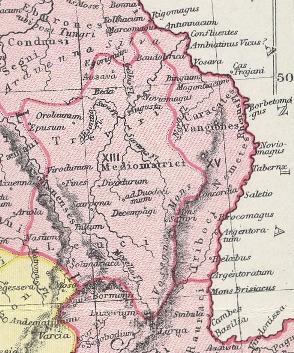
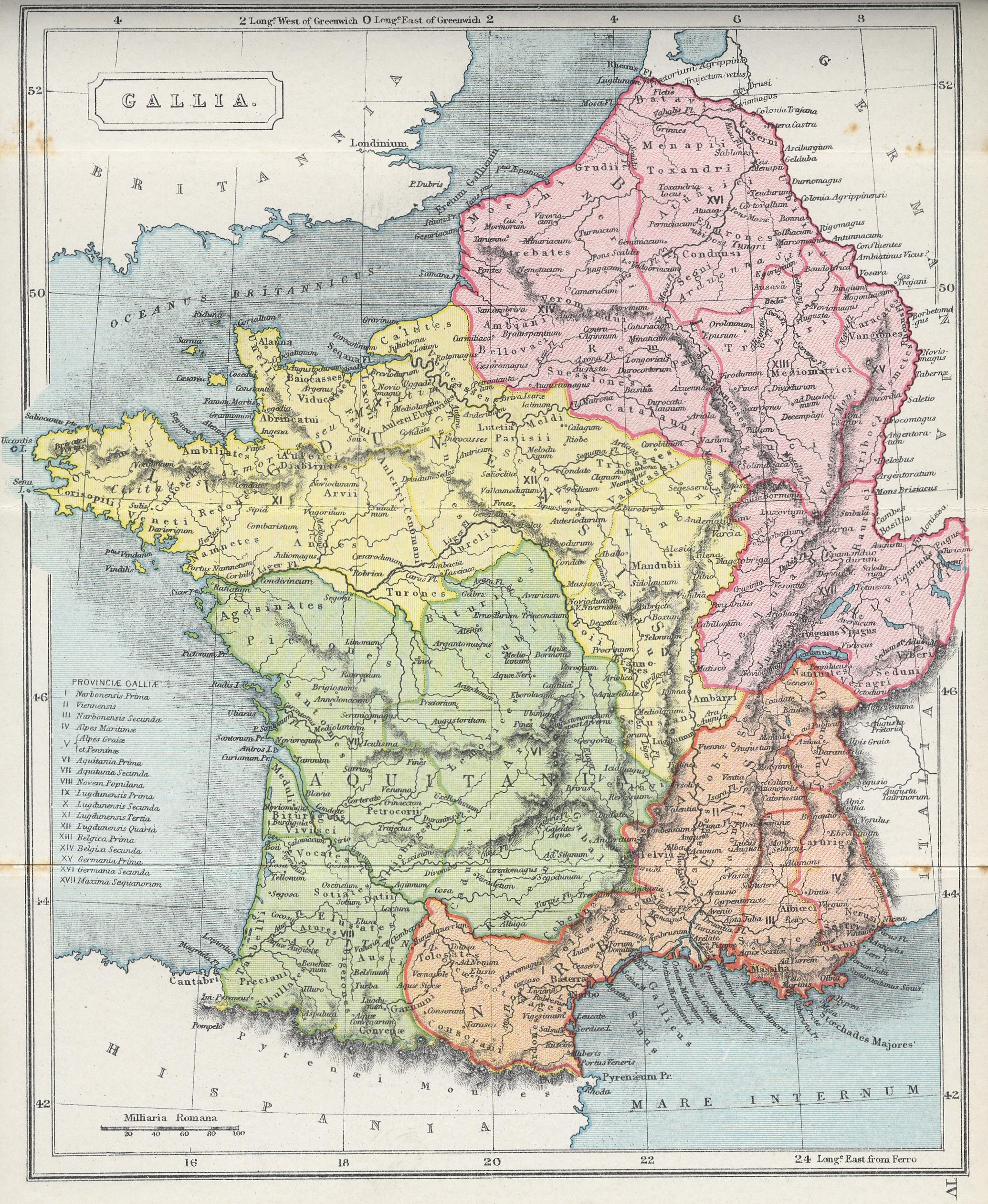
English: A section of the map "GALLIA," from The Atlas of Ancient and Classical Geography showing the late Roman provinces of Germania Prima and Belgica Prima.
Interlingua: Un section del mappa "GALLIA," ex The Atlas of Ancient and Classical Geography monstrante le provincias roman tardive de Germania Prime e Belgica Prime. |
| Dato | |
| Kilde | Project Gutenberg: http://www.gutenberg.org/files/17124/17124-h/images/gallia.jpg |
| Opphavsperson | Samuel Butler |
| Andre versjoner | Centrone map.jpg |
Lisensiering
This media file is in the public domain in the United States. This applies to U.S. works where the copyright has expired, often because its first publication occurred prior to January 1, 1930, and if not then due to lack of notice or renewal. See this page for further explanation.
|
 | |
 |
Filhistorikk
Klikk på et tidspunkt for å vise filen slik den var på det tidspunktet.
| Dato/klokkeslett | Miniatyrbilde | Dimensjoner | Bruker | Kommentar | |
|---|---|---|---|---|---|
| nåværende | 27. feb. 2010 kl. 23:19 | | 587 × 704 (164 KB) | wikimediacommons>QuartierLatin1968 | {{Information |Description={{en|1=A section of the map "GALLIA," from ''The Atlas of Ancient and Classical Geography'' showing the late Roman provinces of Germania Prima and Belgica Prima.}} {{ia|1=Un section del mappa "GALLIA," ex ''The Atlas of Ancient |
Filbruk
Den følgende siden bruker denne filen: