Fil:Beaver wars map.jpg
Hopp til navigering
Hopp til søk

Størrelse på denne forhåndsvisningen: 710 × 600 piksler. Andre oppløsninger: 284 × 240 piksler | 568 × 480 piksler | 871 × 736 piksler.
Opprinnelig fil (871 × 736 piksler, filstørrelse: 163 KB, MIME-type: image/jpeg)
| Beskrivelse |
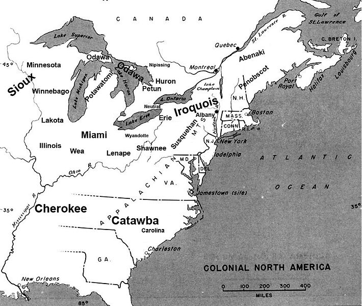
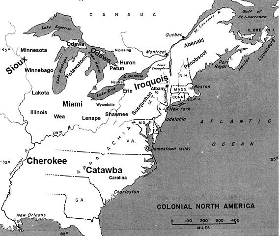
English: Map of the location of major tribes involved in the Beaver Wars laid against a period map showing colonial settlments |
||
| Dato | |||
| Kilde | Eget verk | ||
| Opphavsperson | Charles Edward | ||
| Tillatelse (Gjenbruk av denne filen) |
|
Info
This represents the approximate configuration of the tribes in 1648. Although the areas are large, the populations were low and large parts of the territories where uninhabited, and instead used as hunting grounds. The tribes were also semi nomadic, and the period was rife with war and several of the tribes on the map were destroyed in the 1650s. The map was made using information in several books incluing:
- Jennings, Francis (1984) The Ambiguous Iroquois Empire ISBN: 0393017192.
- Wallace, Paula W (2007) Indians in Pennsylvania, DIANE Publishing Inc ISBN: 1422314936.
Filhistorikk
Klikk på et tidspunkt for å vise filen slik den var på det tidspunktet.
| Dato/klokkeslett | Miniatyrbilde | Dimensjoner | Bruker | Kommentar | |
|---|---|---|---|---|---|
| nåværende | 19. nov. 2008 kl. 00:34 | | 871 × 736 (163 KB) | wikimediacommons>Charles Edward | Slight adjustment to name on image |
Filbruk
Den følgende siden bruker denne filen: