Fil:Austro-Hungarian Monarchy (1914).svg
Fra Wikisida.no
Hopp til navigering
Hopp til søk
Størrelse for denne PNG-forhåndsvisningen av denne SVG-filen: 450 × 456 piksler Andre oppløsninger: 237 × 240 piksler | 474 × 480 piksler | 758 × 768 piksler | 1 011 × 1 024 piksler | 2 021 × 2 048 piksler.
Opprinnelig fil (SVG-fil, standardstørrelse 450 × 456 piksler, filstørrelse: 456 KB)
Denne filen er fra Wikimedia Commons og kan brukes av andre prosjekter. Beskrivelsen fra filbeskrivelsessida vises nedenfor.
Beskrivelse
Bildetekster
Legg til en kort forklaring på hva filen representerer
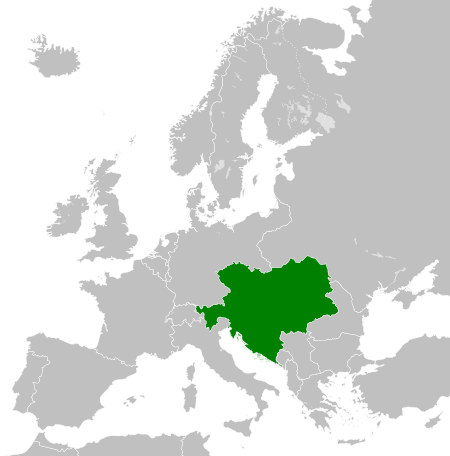
The Austro-Hungarian Monarchy in 1914.
Máte špatně vyznačenou hranici mezi Polskem A Německem
L'impero austro-ungarico nel 1914
L'Empire Austro-Hongrois en 1914
Osztrák-Magyar Monarchia 1914-ben
Monarchia Austro-Węgierska w 1914.
Dubbelmonarkin Österrike-Ungerns utbredning år 1914
Тэрыторыі Аўстра-Венгерскай манархіі ў 1914 годзе
Територии Австро-Венгрии в 1914
Elementer som er med i denne fila
motiv
8. mar. 2012
image/svg+xml
c1ede94fd55b212ad20f67a6c5bb64fc20941ab6
466 571 byte
456 piksel
450 piksel
Filhistorikk
Klikk på et tidspunkt for å vise filen slik den var på det tidspunktet.
| Dato/klokkeslett | Miniatyrbilde | Dimensjoner | Bruker | Kommentar | |
|---|---|---|---|---|---|
| nåværende | 25. jul. 2013 kl. 19:34 | 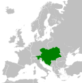 | 450 × 456 (456 KB) | wikimediacommons>Alphathon | Removed Dutch polders (weren't completed until the mid 20th century) |
Filbruk
De følgende 2 sidene bruker denne filen:
Metadata
Denne filen inneholder tilleggsinformasjon, sannsynligvis lagt til av digitalkameraet eller skanneren som ble brukt til å lage eller digitalisere det.
Hvis filen har blitt forandret fra utgangspunktet, kan enkelte detaljer være unøyaktige.
| Kort tittel | Countries of Europe |
|---|---|
| Bildetittel | A blank Map of Europe. Every country has an id which is its ISO-3166-1-ALPHA2 code in lower case.
Members of the EU have a class="eu", countries in europe (which I found turkey to be but russia not) have a class="europe".
Certain countries are further subdivided the United Kingdom has gb-gbn for Great Britain and gb-nir for Northern Ireland. Russia is divided into ru-kgd for the Kaliningrad Oblast and ru-main for the Main body of Russia. There is the additional grouping #xb for the "British Islands" (the UK with its Crown Dependencies - Jersey, Guernsey and the Isle of Man)

Contributors.
Original Image: (http://commons.wikimedia.org/wiki/Image:Europe_countries.svg) Júlio Reis (http://commons.wikimedia.org/wiki/User:Tintazul).
Recolouring and tagging with country codes: Marian "maix" Sigler (http://commons.wikimedia.org/wiki/User:Maix)
Improved geographical features: http://commons.wikimedia.org/wiki/User:W!B:
Updated to reflect dissolution of Serbia & Montenegro: http://commons.wikimedia.org/wiki/User:Zirland
Updated to include British Crown Dependencies as seperate entities and regroup them as "British Islands", with some simplifications to the XML and CSS: James Hardy (http://commons.wikimedia.org/wiki/User:MrWeeble)
Released under CreativeCommons Attribution ShareAlike (http://creativecommons.org/licenses/by-sa/2.5/). |
| Bredde | 450 |
| Høyde | 456 |


